Mount Kaputar
Mountain in New South Wales, Australia

Mount Kaputar
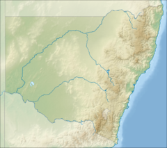
New South Wales, Australia
Mount Kaputar, a mountain with an elevation of 1,489 metres (4,885 ft) above sea level,[1] is located near Narrabri in northern New South Wales. It is part of the Nandewar Range and has been preserved within the Mount Kaputar National Park. The mountain is a prominent landmark for travellers on the Newell Highway as it rises abruptly from the plains. In the cold of winter the mountain may receive a light dusting of snow.[2][3]
Access
The summit is accessible from Narrabri via a 57-kilometre (35 mi) long, winding and narrow road that is partly sealed. Neighboring Mount Dowe, with an elevation of 1,457 metres (4,780 ft) above sea level, contains various telecommunications broadcasting equipment and the large antenna is visible from the Kamilaroi Highway heading south towards Gunnedah.
There is a lookout at the top of the peak called Mount Kaputar Lookout. Nearby is the Governor Lookout and Eckfords Lookout as well as Dawson Spring with cabins, picnic tables and camping facilities.[4]

Geology
Mount Kaputar is the remnants of an extinct volcano that was active about 18 million years ago.[4] Mount Lindesay was probably the centre of the volcano. The predominant vegetation on the mountain is dry sclerophyll forest.[4]
Flora
The main vegetation types are dry rainforests, dry eucalypt forests and heathlands. A sub-alpine zone known as the Kaputar Plateau forms an elevated area 1,350 metres (4,430 ft) above sea level.[5] Here the main vegetation type is open eucalypt forest dominated by snow gum, ribbon gum and mountain gum.[5] Below this down to 1,000 metres (3,300 ft) above sea level the most common trees include the silver-top stringybark and rough-barked mountain gum.[5] Heath occurs in scattered patches where exposure to high winds and shallow soils inhibits the growth of larger trees.
Fauna
The mountain is home to a giant, fluorescent pink slug, which can grow up to 20 centimetres (7.9 in) in length.[6] This pink species is found only on this single mountaintop.[7] The peak is an isolated habitat island on which endemic invertebrates and plant species have existed for millions of years.[6] According to a park ranger there are three species of cannibal snails on the mountain.[8]
See also
 New South Wales portal
 Mountains portal


References
- ^ a b "Mount Kaputar - NSW". ExplorOz. I.T. Beyond Pty Ltd. 2015. Retrieved 27 May 2015.
- ^ Snow on Mount Kaputar, Oz Forecast
- ^ Hutton, Geoffrey (1983). Australia's Natural Heritage (2nd ed.). pp. 102. Collins. ISBN 0-00-217297-6
- ^ a b c Mount Kapural National Park park guide.[brochure] New South Wales National Parks and Wildlife Service. June 1994.
- ^ a b Ben Cubby (29 May 2013). "One will really amaze you, the other just eats his mates". Sydney Morning Herald. Fairfax Media. Retrieved 31 May 2013.
- ^ Carrier Arnold (10 June 2013). "New Hot-Pink Slug Found in Australia". National Geographic. Retrieved 18 December 2018.
- ^ Dylan Stableford (30 May 2013). "Giant, fluorescent pink slugs found on mountain". Yahoo! News. Retrieved 1 June 2013.
External links
- Weather station with webcam, Operated by Oz Forecast
- v
- t
- e
(not part of the
Great Dividing Range)
| Mid North Coast |
|
|---|---|
| Allyn, Barrington & Mount Royal |
|
| Gibraltar and Sugarloaf |
|
| Blue Mountains |
|
| Illawarra |
|
| The Budawangs |
|
| Tweed | |||||
|---|---|---|---|---|---|
| McPherson and Nightcap | |||||
| Mid North Coast |
| ||||
| Nandewar |
| ||||
| Liverpool and Watagan |
| ||||
| New England and Moonbi |
| ||||
| Central Tablelands |
| ||||
| The Brindabellas and Scabby |
| ||||
| Monaro |
| ||||
| Snowies |
| ||||
| Other mountains in the GDR |
|
| Barrier |
|
|---|---|
| Warrumbungles |
|
| Other inland mountains |
| Lord Howe |
|---|
a specific range


