Pristava pri Mestinju
Place in Styria, Slovenia
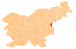
46°11′46.01″N 15°35′43.29″E / 46.1961139°N 15.5953583°E / 46.1961139; 15.5953583 Slovenia
 (2002)
Pristava pri Mestinju (pronounced [ˈpɾiːstaʋa pɾi mɛˈstiːnju]) is a settlement in the Municipality of Podčetrtek in eastern Slovenia. It lies on the main road from Podčetrtek to Rogaška Slatina. The area is part of the traditional region of Styria. It is now included in the Savinja Statistical Region.[2]
Name
The name of the settlement was changed from Pristava to Pristava pri Mestinju in 1953.[3]
References
External links
- Pristava pri Mestinju on Geopedia
- v
- t
- e
Administrative seat: Podčetrtek
| Current |
|
|---|---|
| Former |
|
- Olimje Castle
- Podčetrtek Castle
- St. Lawrence's Parish Church
- St. Mary the Virgin Church on Pesek Hill
 | This article about the Municipality of Podčetrtek in Slovenia is a stub. You can help Wikipedia by expanding it. |
- v
- t
- e


