Sodna Vas
Place in Styria, Slovenia
46°10′29.85″N 15°35′51.32″E / 46.1749583°N 15.5975889°E / 46.1749583; 15.5975889 Slovenia
 (2002)
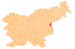
Sodna Vas (pronounced [ˈsoːdna ˈʋaːs]; Slovene: Sodna vas, German: Schöpfendorf[2]) is a small settlement in the Municipality of Podčetrtek in eastern Slovenia. The area is part of the traditional region of Styria. It is now included in the Savinja Statistical Region.[3]
References
External links
- Sodna Vas on Geopedia
- v
- t
- e
Administrative seat: Podčetrtek
| Current |
|
|---|---|
| Former |
|
- Olimje Castle
- Podčetrtek Castle
- St. Lawrence's Parish Church
- St. Mary the Virgin Church on Pesek Hill
 | This article about the Municipality of Podčetrtek in Slovenia is a stub. You can help Wikipedia by expanding it. |
- v
- t
- e


