Grendon and Doddershall Woods
| Site of Special Scientific Interest | |
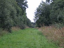 Path in Doddershall Wood | |
| Location | Buckinghamshire |
|---|---|
| Grid reference | SP710210 |
| Interest | Biological |
| Area | 67.1 hectares |
| Notification | 1984 |
| Location map | Magic Map |
Grendon and Doddershall Woods are a 67.1-hectare (166-acre) biological Site of Special Scientific Interest in Grendon Underwood in Buckinghamshire. The local planning authorities are Aylesbury Vale District Council and Buckinghamshire County Council.[1][2]
The site is broadleaved oak woodland on north Buckinghamshire clay, with an understorey of hazel and blackthorn. Herbs include primrose and wood anemone, and small streams and wide rides provide additional habitats. The woods have 35 butterfly species, including the rare black hairstreak. There were five species of fritillary, but some have not been seen since the late 1970s. Breeding birds include nightingales.[1]
There is access by footpaths from Grendon Underwood.[3]
Wikimedia Commons has media related to Grendon and Doddershall Woods.
References
- ^ a b "Grendon and Doddershall Woods citation" (PDF). Sites of Special Scientific Interest. Natural England. Retrieved 24 September 2015.
- ^ "Map of Grendon and Doddershall Woods". Sites of Special Scientific Interest. Natural England. Retrieved 24 September 2015.
- ^ "Grendon & Doddershall Woods - Butterflies". Wildlife Extra. Retrieved 24 September 2015.
- v
- t
- e
- Ashridge Commons and Woods
- Aston Clinton Ragpits
- Aston Rowant
- Aston Rowant Woods
- Bacombe and Coombe Hills
- Black Park
- Bradenham Woods, Park Wood and The Coppice
- Burnham Beeches
- Buttlers Hangings
- Dancersend
- Dancersend Waterworks
- Ellesborough and Kimble Warrens
- Fayland Chalk Bank
- Finemere Wood
- Foxcote Reservoir and Wood
- Frieth Meadows
- Frogmore Meadows
- Gomm Valley
- Grangelands and Pulpit Hill
- Grendon and Doddershall Woods
- Ham Home-cum-Hamgreen Woods
- Hodgemoor Wood
- Hollowhill and Pullingshill Woods
- Homefield Wood
- Howe Park Wood
- Ivinghoe Hills
- Kingcup Meadows and Oldhouse Wood
- Kings and Bakers Woods and Heaths
- Littleworth Common
- Lodge Hill
- Long Herdon Meadow
- Mid Colne Valley
- Millfield Wood
- Moorend Common
- Naphill Common
- Old Rectory Meadows
- Oxley Mead
- Pilch Fields
- Pitstone Hill
- Poker's Pond Meadow
- Rodbed Wood
- Rushbeds Wood and Railway Cutting
- Shabbington Woods Complex
- Sheephouse Wood
- Stoke Common
- Swain's Wood
- Temple Island Meadows
- Tingewick Meadows
- Tring Reservoirs
- Turville Hill
- Weston Turville Reservoir
- Widdenton Park Wood
- Windsor Hill
- Wormsley Chalk Banks
- Yardley Chase
51°52′55″N 0°59′07″W / 51.881835°N 0.985168°W / 51.881835; -0.985168


