Fredriksen Island
Island in Antarctica
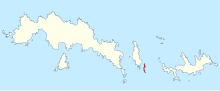
Fredriksen Island is an island 5 km (3.1 mi) long and 1 km (0.62 mi) wide, lying 1 km south-east of Powell Island in the South Orkney Islands of Antarctica. It was discovered by Captains Nathaniel Palmer and George Powell in the course of their joint cruise in December 1821. It was named by Norwegian whaling captain Petter Sorlle, who made a running survey of the island in the 1912–13 summer.[1]
Important Bird Area
The island lies within an Antarctic Specially Protected Area (ASPA 111). It is also part of the Southern Powell Island and adjacent islands Important Bird Area (IBA), identified as such by BirdLife International because it supports significant seabird breeding colonies.[2]
See also
- Cape Barlas
- List of Antarctic and subantarctic islands
References
- ^ "Fredriksen Island". Geographic Names Information System. United States Geological Survey, United States Department of the Interior. Retrieved 9 April 2012.
- ^ "Southern Powell Island and adjacent islands". BirdLife data zone: Important Bird Areas. BirdLife International. 2013. Archived from the original on 10 July 2007. Retrieved 19 January 2013.
![]() This article incorporates public domain material from "Fredriksen Island". Geographic Names Information System. United States Geological Survey.
This article incorporates public domain material from "Fredriksen Island". Geographic Names Information System. United States Geological Survey.
- v
- t
- e
- Admiralty Bay
- Ardley Island
- Byers Peninsula
- Cape Shirreff
- Collins Point
- Coppermine Peninsula
- Crater Lake
- Deception Island
- Discovery Bay
- Fildes Peninsula
- Harmony Point
- Kroner Lake
- Lions Rump
- Mount Pond
- Narębski Point
- Pendulum Cove
- Port Foster
- Potter Peninsula
- Ronald Hill
- San Telmo Island
- South East Point
- Stonethrow Ridge
- Suffield Point
- Telefon Bay
- Christoffersen Island
- Coronation Island
- Fredriksen Island
- Grey Island
- Lynch Island
- Michelsen Island
- Moe Island
- Southern Powell Island
60°44′S 44°59′W / 60.733°S 44.983°W / -60.733; -44.983
 | This South Orkney Islands location article is a stub. You can help Wikipedia by expanding it. |
- v
- t
- e


